NYC Manhattan Red Map

NYC Manhattan Red Map
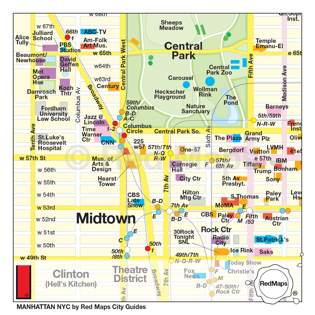
From Harlem to Central Park, Midtown and Downtown, the NYC Manhattan Red Map covers Manhattan and includes a zoom-in map of the World Trade Center area. This is the comprehensive guide to Manhattan’s arts, shopping and culture, giving you the big picture you need.
Shop United States adapter plugs
NYC Manhattan Red Map Features:
- Dimensions open 24" x 9.5" / closed 4" x 9.5"
- Material is matte laminated for easy daylight reading
- Style # 8801
Red Map NYC Manhattan covers: From 110th Street, south to the Financial District, with SoHo, Lower East Side, Greenwich Village, Upper West Side and Upper East Side, Gramercy Park, the High Line and Madison Square.
Attractions on the map include: Central Park, Empire State & Chrysler Buildings, 9/11 Memorial & museum, Metropolitan, MAD, Guggenheim and Whitney museums, Ellis Island, Gracie Mansion, Statue of Liberty and Elis Island Ferry, Rose Planetarium, Museum of Natural History, Chelsea Food Market, Skyscraper Museum, Tenement Museum, New Museum, The Cloisters, Saturday Night Live, Letterman and Tonight Show studios plus a lot more to make your New York City trip memorable.
Learn more about what is happening in NYC at www1.nyc.gov
ABOUT RED MAP
Red Maps does not accept advertising so maps are clean and easy to read. Places of interest are included on Red Maps because they are noteworthy. Red Map's philosophy makes it easy to be true to what they do by staying objective.
Red Maps are cool, high-design guides. Stamps of approval have come in the form of great press reviews and that the maps are sold around the world in better stores. Red Maps has also been invited to create custom guides for among others, LondonFashionWeek, Art Basel Miami Magazine, Le Bon Marche, Mandarin Oriental, and World Cup clients.
Follow Red Map on social
Facebook RedMaps
Twitter @redmaps
Pinterest @RedMaps
Google Plus @RedMaps
tumble @redmaps
Instagram @redmaps